
Blog 3: Places Along the Castlereagh Highway
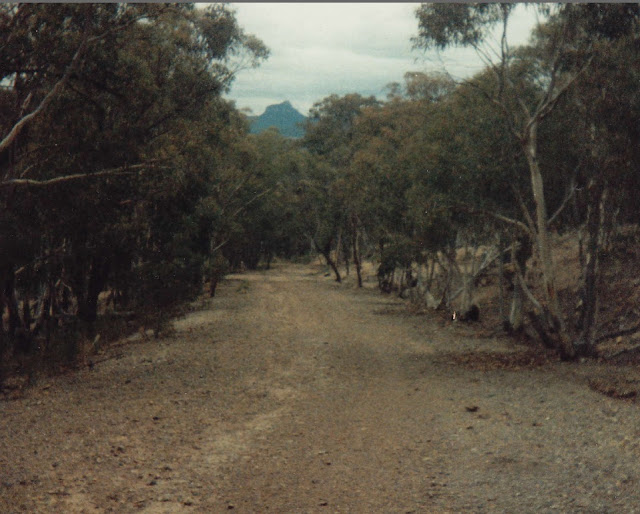
Ilford is one of those villages that seems lost in the past. It had an early beginning in the 1830s as a village reserve named Keenes Swamp, where ten acres were set aside as a halting place. Population grew in the 1850s with the sale of five acre lots at £1.10.0 an acre (if you can’t read that, let’s say $3). By the 1870s it was having its heyday. There was a public school for 30 to 40 children, two churches, two stores, a post office, police station, inn (The Plough), carpenter, baker, butcher, blacksmith and population of around 100. Ilford was anticipating the Wallerawang-Mudgee railway steaming right past the village. But it was sideswiped. The railway headed for Rylstone and thus Ilford went into decline. By the way that mountain you can see, Mt Ilford, used to be called Mt Misery. According to a young writer, Roy Moore, to the Catholic Press in 1929, it was first called Mt Inaccessible before changing to Mt Misery “this last 20 years”. [1]
So now we take the turnoff towards Kandos. But first let me tell you that an earlier route to Kandos went down Petticoat Lane on Petticoat Hill, described by someone: “as stiff a pinch as a man need negotiate in a day’s march”. How did that name come about? I guess it is tall and steep like a woman’s petticoat, but you might have other theories. It was surely named by a man. In 1876 the Rylstone mail coach, a two horse buggy with seven passengers and a “large quantity of baggage”, bolted down that lane, the axle broke and a couple of humans were thrown overboard, but no deaths. The Petticoat Lane thoroughfare was abandoned in 1952.
We come to the ubeaut two lane bridge over Carwell Creek. In the early days it was just a crossing place, then for many decades a single lane bridge. That caused some anxiety! The creek runs through the old Carwell property, the first in the area I think (1829), established by the pioneering Vincent and Nevell families. You might have crossed another part of Carwell Creek on the Cudgegong Road. There were occasional attempts at gold sluicing in the creek at the turn of the century.
The next spot on our route is Clandulla, which you can glimpse through the bush. Have you driven around Clandulla? It’s a homey little village, which means, mainly homes. Clandulla Railway Station which opened in 1884 is worth seeing. It wasn’t named till 1905, having gone through four different name changes, first Carwell, then Ilford, followed by Mornington, Carwell again and finally Clandulla. The most likely origin of the name is Scottish (Clan Duille is a Scottish clan associated with the McLean family who settled in the Capertee Valley). [2]
We’ll bypass Kandos this time and head towards Rylstone. On your left, from about the swimming pool to Larges Lane, was known as Criminal Hill, also referred to by Council as Hatton’s Hill, perhaps to enhance the area. It had quite a reputation. Accommodation was scarce and costly and a shanty settlement of about twenty families grew there. Being outside the urban area it had no garbage or sanitary arrangements and a typhoid scare brought the locality to the attention of health authorities.
The next hill between Kandos and Rylstone, opposite what was, in the early days, Dawson’s property, is known to locals as Dog Trap, though there is no sign there. It was the scene of a number of alarming accidents in the first half of last century. The Geographical Names Board lists 44 Dog Traps in NSW including at Granville, Lithgow, Tumut, Gloucester, Walcha and Meroo, though not Kandos. That large number is an indication that native and wild dogs were a common scourge for sheep farmers, who spent a lot of time trying to trap them. Dog traps were as common as camp ovens. They were usually steel with a heavily weighted door which clanged shut after the dog was lured in with poisoned meat, or dog droppings, or a fire. Another trap was a ten feet pit covered with light twigs and leaves, with pathways leading from various directions to lure the dogs.
On your right you will see a number of five acre semi-rural properties, part of Rathdowney Estate. Frank Smiles who owned the land at one time named it Rathdowney after the small town in Queensland.
Well, that’s all I have about place names, for the moment. Note that Brent’s topic has resulted in three blogs so far. It’s been fun learning all this history. If there are any local place names you would like me to research, shoot me an email via this website.
[1]You can learn more about Ilford on this site kandoshistory.com under Publications, Articles, “Ilford’s Hidden Trail of History”.
[2]You can learn more about Clandulla on this site kandoshistory.com under Publications, Articles, “What’s in a Name?”
The featured image of the old road to Kandos called Petticoat Hill comes from https://oldimagesrylstone.blogspot.com/2012/07/petticoat-hill.html
Photo: Lynn Ryan collection

On page 97 of Bill Staff’s History of Rylstone there is a good story about the Catholic Priest Father Corbett and Petticoat Lane. You might like to add that some time.
LikeLike
I just remembered a couple more Petticoat Lane stories. Dad and mum’s first car was 1938 Willys and we used to travel to and from Wollongong quite a lot but the car always boiled going up Petticoat Lane – it was that last steep pinch. Dad would stop, let the car cool down and we would be on our way again. It also boiled on the way home going up Bulli Pass.
When I was in high school at the Convent the girls’ basketball team was invited to Portland to play basketball and the nuns asked mum if she could take a few of us in our car. We had not long before that purchased our 48 215 (1953) Holden. Mum said she would take us but she was very apprehensive about driving up Petticoat Lane (she had not done much driving in her life) so dad just told her to stop at the bottom, put the car in low gear and travel slowly up the hill. We did get to and from Portland that day but don’t remember if we won at basketball.
LikeLike
Great stories Denise about climbing Petticoat Hill. I love the courage of our mothers back in those days. I did read the story of Father Corbett. However I didn’t feel I had enough space in that little section of the road to relate it but I always appreciate your suggestions. Colleen
LikeLike
Thank you for your interesting story, it bought back many happy memories. I remember travelling over the old Petticoat Hill many times. We used travel it by bus on our way to play sport against Portland High School.
Frank Smilles bought his Rathdowney off my grandfather’s estate ( W A Moss) which was known as Bluestone. It extended from the Rylstone/Kandos road across the railway line towards the Glen Alice Rd and met with “Kildare”,Alf Halpin’s property, back towards Kandos and met with George’s property and on the Rylstone side with Dabee.
LikeLike
Hi Gwen
I have many happy memories of visits/picnics at Bluestone. This is my story.
In 1947 my mum Una Day was in Rylstone when my sister Carole was born on 12th January. Also in hospital at the time was Terry Moss when Narelle was born (14/1/1947). We somehow became friends with the Moss family and then when Terry was in hospital in 1948 when Kay was born we looked after Narelle. I remember one visit when we were sitting around the dam and one of the kids threw my aunt’s sandal in the dam. It took a lot to retrieve it!!
So many happy memories!!
Denise Jamieson
LikeLike
I love to hear these local stories. they bring history alive. Colleen
LikeLike